Can Paratransit Evolve Alongside African Cities?
15 February 2019
May 22nd – DT4A at ITF in Leipzig
20 May 2019By Lily Bui and Griffin Kantz, 3/29/2019
When you first start out collecting, analyzing, editing, and visualizing GTFS data, the landscape of available tools can be overwhelming. There are seemingly endless lists of tools to use, and each tool has its own advantages and limitations. So how does your team decide the right tools for your mapping project?
To answer this question, we’re selecting Digital Transport’s favorite transit data collection tools. When building this list, we’re looking at whether the tool allows for collecting GPS traces, bus stops and passenger counts, whether the tools is free or open-source, and whether the tool sends data to OpenStreetMap. We also look at the mapping projects the tools have been used in and weigh the pros and cons.
Below is Digital Transport’s top 10 mobile tools for collecting transit data –
1. AllyApp
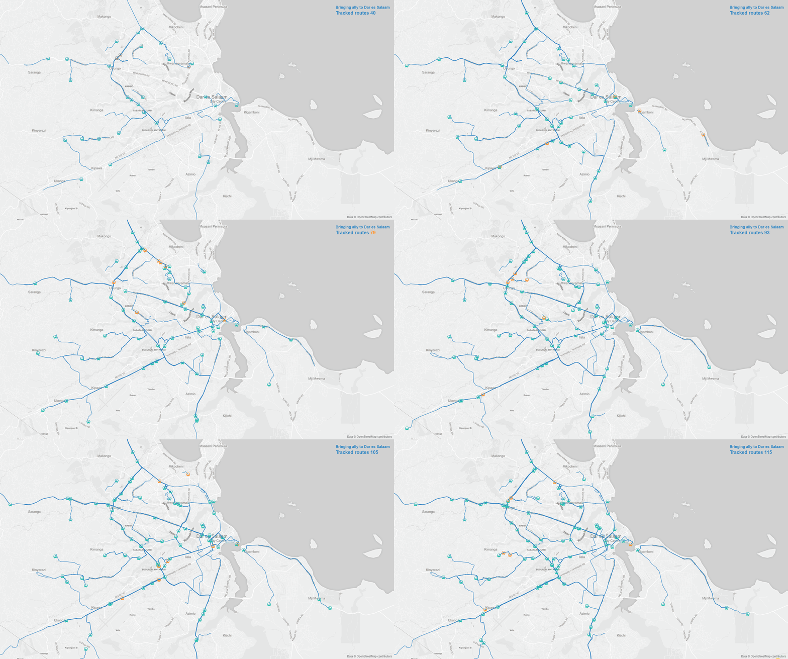
Using AllyApp to collect Dar es Salaam’s minibus taxi, or ‘daladala’, routes. Learn more about the collaborative project from the Dar Rumani Huria website: http://ramanihuria.org/putting-dar-es-salaam-dala-dalas-map/
Does it collect GPS traces?
Does it collect bus stops?
Does it collect passenger counts?
Is it free?
Does it connect with OpenStreetMap?
What projects was it used in?
Quito, Ecuador; Mapping ZedTransit in Lusaka, Zambia; Mapping daladals in Dar es Salaam
Why we like it
It allows app-users to crowdsource data and offers a manifold of APIs and partners. It also has a transit routing feature for navigation.
Download the app here.
2. DataMobile/Iterum
Does it collect GPS traces?
Does it collect bus stops?
Does it collect passenger counts?
Is it free?
Does it connect with OpenStreetMap?
What projects was it used in?
Why we like it
Allows institutions to carry out their own mobility surveys. However, it is better suited to collect survey data on mobility habits than to describe a transport network.
Download the app here.
3. FlockTracker
Making of Digital Matatus Map : Part 1 from Sarah Williams on Vimeo.
Does it collect GPS traces?
Does it collect bus stops?
Does it collect passenger counts?
Is it free?
Does it connect with OpenStreetMap?
What projects was it used in?
Mapeando el Transporte Urbano en Cartagena, Colombi
Why we like it
Allows for lat-long data collection on phones and can be modified to allow for survey questions. However, it needed many modifications for use in transit mapping and earlier versions had faulty connection with GPS satellites. It also does not snap lat-long to roadways, leading to larger need for post-processing
Download the app here.
4. Fulcrum
Does it collect GPS traces?
Does it collect bus stops?
Does it collect passenger counts?
Is it free?
Does it connect with OpenStreetMap?
Why we like it
Similar functionality to FlockTracker. However, the tool is native to Apple iPhones, which are less commonly used in developing cities.
Download the app here.
5. GoMetroPro
Does it collect GPS traces?
Does it collect bus stops?
Does it collect passenger counts?
Is it free?
Does it connect with OpenStreetMap?
What projects was it used in?
Numerous bus companies & cities in Australia. It was also used in South Africa and Kampala, Uganda
Why we like it
Extremely user-friendly interface that was custom-built for mapping South Africa’s minibus taxi routes. The company can also participate in the data collection process.
Learn more here.
6. GPS Essentials
Does it collect GPS traces?
Does it collect bus stops?
Does it collect passenger counts?
Is it free?
Does it connect with OpenStreetMap?
What projects was it used in?
WRI used it for a public transport project in Addis Ababa, Ethiopia.
Why we like it
Versatile tool that has numerous GPS apps for smartphone. It’s capable of logging numerous attributes per entry. However, the tool is not custom-built for transit mapping and stops cannot be entered while route is being tracked.
Download the app here.
7. JungleBus (beta)
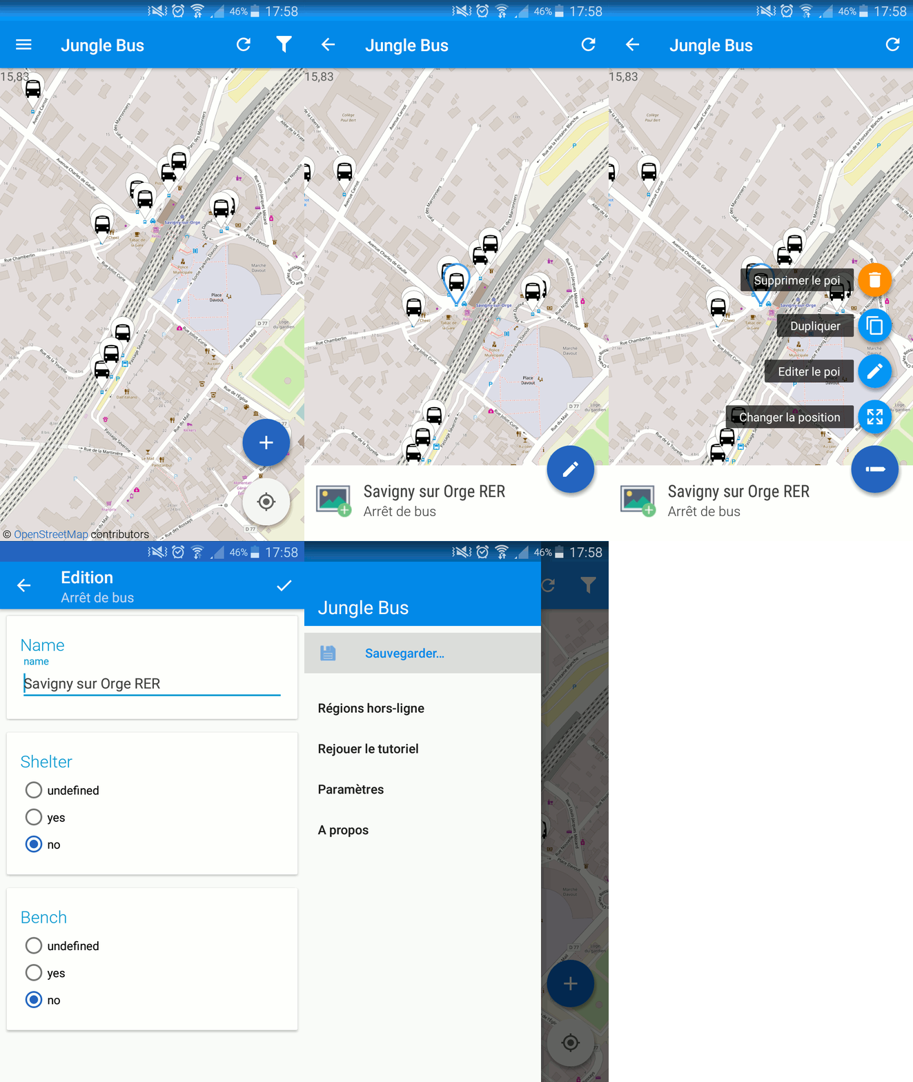
JungleBus stop collection interface
Does it collect GPS traces?
Does it collect bus stops?
Does it collect passenger counts?
Is it free?
Does it connect with OpenStreetMap?
What projects was it used in?
A number of transit mapping projects in Accra (Ghana), Paris, Bamako (Mali), Dakar (Senegal), Kinshasa (D.R.C.), Freetown (Sierra Leone), and Niamey (Niger).
Why we like it
This free, open-source Android app is focused exclusively on collecting bus stop information, including lat-long data.
Learn more here.
8. OpenGPSTracker
Does it collect GPS traces?
Does it collect bus stops?
Does it collect passenger counts?
Is it free?
Does it connect with OpenStreetMap?
What projects was it used in?
Why we like it
A standard, no-frills app-based GPS trace collector. Not integrated with any particular GTFS of transit tool.
Learn more here.
9. OSM Tracker
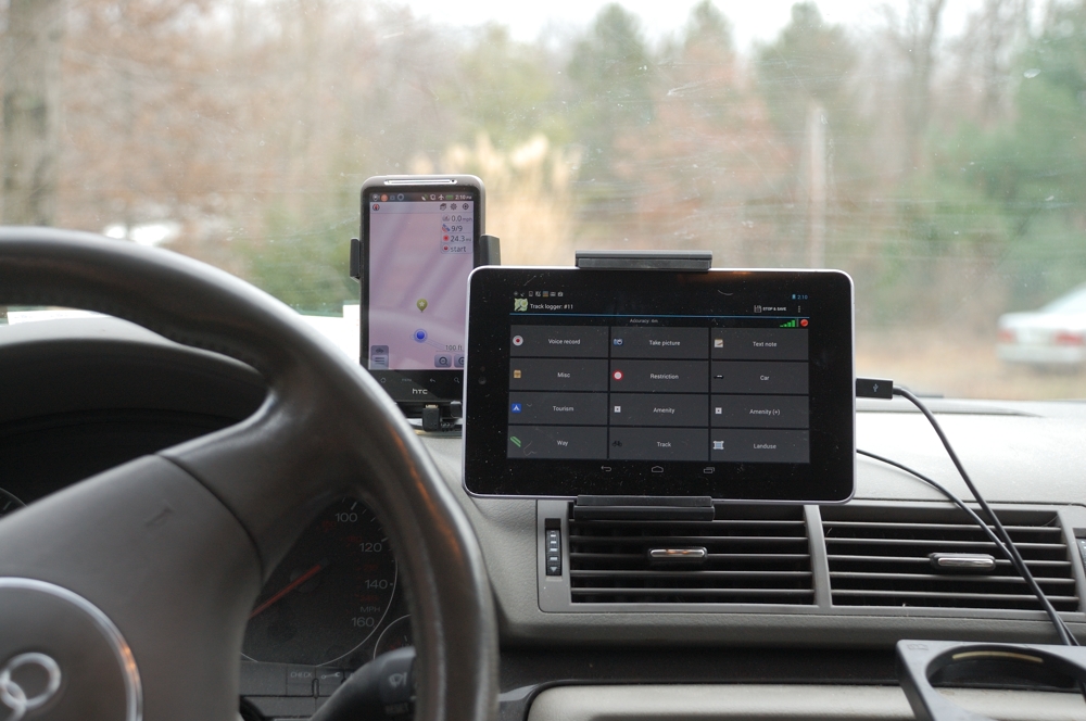
OSM contributor using OSMTracker to collect GPS traces on their driving route. Photo courtesy of OpenStreetMap Wiki.
Does it collect GPS traces?
Does it collect bus stops?
Does it collect passenger counts?
Is it free?
Does it connect with OpenStreetMap?
What projects was it used in?
Duitama (Colombia), Mapanica (Nicaragua); widely used for general contributions to OSM.
Why we like it
A GPS tracker combined with a build-it-yourself, app-based survey form that allows you to record stop and route information. Data can also be directly synced to OpenSteetMap, making this the go-to tool for OSM contributors.
Learn more here.
10. TransitWand (Conveyal)
Does it collect GPS traces?
Does it collect bus stops?
Does it collect passenger counts?
Is it free?
Does it connect with OpenStreetMap?
What projects was it used in?
Digital Matatus; Mexico City, Mexico
Why we like it
There are number of strengths with TransitWand as the tool was specifically designed with collecting GTFS data in mind. It allowed for modification of questions asked in field, had good user interface, and data can be downloaded as .csv and shapefiles. That said, Digital Matatus reported that the program needed modification for use in field and that the GTFS export does not function properly, making post-processing cumbersome.
Learn more here.
The verdict?
There’s a number of transit data collection tools out there, each with their own sets of strengths and limitations, and with prices ranging from free-to-download to more resource-intensive. The tool that works best for your projects ultimately depends on your team’s needs and resources. That said, this list is by no means exhaustive. You can find a full list of GTFS tools and resources in Digital Transport’s Knowledge Center, with tools created or compiled by the Center of Urban Transportation Research at the University of South Florida, WRI, Esri and others. If you have any questions, comments, or suggestions on GTFS tools, get in touch with us!
About the Authors
Lily Bui is a PhD candidate at MIT’s Department of Urban Studies & Planning. Her research focuses on warning systems and disaster risk reduction planning on islands.
Griffin Kantz is a 2020 Master of City Planning student at MIT, with a B. of S. degree in sustainable planning from USC. He can be reached at kantz@mit.edu.
