Who Are the DT4A Innovation Challenge Jury Members?
4 April 2022
Setting Up Data Collection Projects to Meet Passenger Capabilities
1 June 2022« Create, update and visualize your GTFS datasets easily and collaboratively with WatriFeed »
GTFS Standard
The standardization of transport data in Africa and particularly in West Africa is a major challenge to improve mobility. Standardization of transport data will promote openness, sharing and reuse of data to boost innovation in the transport sector. Today, many transport data standards such as GTFS are currently in use.
The General Transit Feed Specification (GTFS) is an open data format standardized for communicating public transport schedules and the associated geographical information (Topography of the network : location of stops, route layout). The GTFS format allows transit agencies and companies to publish data in a format that can be exploited and used in applications in a way that is interoperable.
To create a GTFS, the use of software or scripts is required, but sometimes their installations, as well as the creation and updating of GTFS, is not accessible to everyone. It is in this context that the Data.Transport association has developed WatriFeed in 2019.
What is WatriFeed?
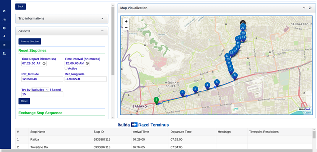
WatriFeed is an open source collaborative web editor that facilitates the creation and updating of GTFS without the need for computer scripting for easy reuse in transportation and mobility applications and services.
WatriFeed is available online but due to its open source code an offline instance can be deployed for local deployment and use without the Internet. It easily integrates data from external sources such as OpenStreetMap and more.
WatriFeed Features
WatriFeed allows:
- Alone or in a team (Collaborative Edition), create your GTFS feed easily using an ergonomic graphical interface ;
- Manage multiple GTFS workflows ;
- Import and update your GTFS feed quickly ;
- Visualise your data in different renderings using the TransitViz integrated visualizer;
- Import data from OpenStreetMap for GTFS creation/conversion ;
- Provide an Application Programming Interface (API) to facilitate reuse of data by developers;
- Ensure quality control, validate and then share your GTFS feed for immediate use.
TransitViz a GTFS Visualizer
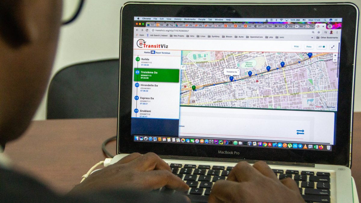
In addition, WatriFeed integrates a data visualizer called TransitViz which, through the WatriFeed API, allows the exploration and analysis of digital transportation data using graphs, interactive web maps and other tools to address the increasing complexity of the available data and draw specific lessons from it.
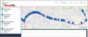
TransitViz is also available online and allows you to visualize GTFS data from other sources besides WatriFeed.
WatriFeed Use Cases
WatriFeed was first used in the project of Mapping of Bamako Urban Transport financed by the World Bank in 2019 to standardize the data of Bamako public transport « Sotrama » in GTFS format.
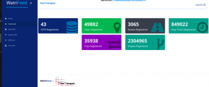
To date, WatriFeed records 43 GTFS, 49882 stops, 3065 routes, 849022 stops times, 35938 trips, 2304965 shapes.
Ongoing Development
The development of WatriFeed is still ongoing in order to integrate and take into account other standards such as GTFS Flex, which would be more adapted to African informal transports.
The Data.Transport Association remains open to any contributions that could improve this editor and is open to support organizations interested in standardizing their data to the GTFS format or beyond.
Links
For documentation on how to create a GTFS using WatriFeed, please check out the following links : https://wiki.openstreetmap.org/wiki/WatriFeed-Editeur-GTFS-Collaboratif
WatriFeed Code source : https://github.com/DataTransport/WatriFeed
WatriFeed : https://watrifeed.ml/
Transitviz : https://transitviz.org/
About the Author
Emmanuel BAMA is a computer science engineer, with a passion for technology and is involved in such initiatives as Data Transport, a non-profit organization that works to improve African mobility through data and technology, Openstreetmap Côte d’Ivoire, an open source collaborative mapping association, and OpenDigitech.SAS, an innovative ICT services integrator. Emmanuel BAMA has provided his expertise to organizations such as the National Democratic Institute, the World Bank, the International Organization of la Francophonie, the Bill & Melinda Gate Foundation, the US State Department-Techcamps, ICRISAT,… Emmanuel BAMA is willingly and actively involved in many technology working groups. He also shares his passions through his personal blog www.emmanuelbama.net
