Who Plans Transit in African Cities? Ask the Bus Drivers.
26 April 2021
Beyond Mapping: Sustainable and Inclusive Transport for Africa (Virtual Event)
15 June 2021At the beginning of 2021, MobilityData and Fabrique des Mobilités took a deep dive into existing GTFS projects across African cities. The goal was to understand the ecosystem around GTFS and open data and connect with Africa-based open data specialists, project owners, and entrepreneurs. DT4A had a virtual sit-down with Kaiomi Inniss, a researcher at MobilityData and open transit data enthusiast to learn more about the results and key takeaways from that project.
Tell us about the ‘Digital Africa Survey Project,’ how did you start?
Our first step was to do a broad overview of the existing GTFS projects in Africa. We used the DT4A Resource Center and OpenMobilityData as a jumping off point. These two resources were crucial in surveying the existing GTFS projects, and helped us find more projects that were not already represented in these two sources.
We wanted to go a bit further and deeply understand today’s data ecosystems and the successes and challenges cities face creating data. We looked at four cities: Accra, Addis Ababa, Bamako, and Cairo. We interviewed around ten people, who included entrepreneurs launching apps in their cities and university students who collected data on mapping projects. We also spoke to larger organizations that have been collecting data in multiple cities across the continent to understand how they operate. This provided us with a variety of perspectives.
The result was a dataset of all the GTFS projects we could find, along with information on the project goals, funding sources, transit systems represented, the last update on the datasets, and other useful information. We also put together a report that outlines the four case cities, giving useful context to the current transit systems, quality assessment of the GTFS datasets, the outcomes of the projects, and the success and drawbacks.
What kind of questions were you exploring in your case cities, and why these four cities?
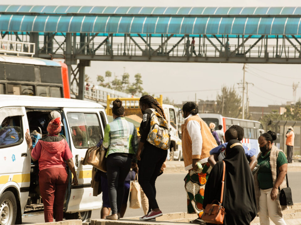
We found these four cities showcased the dynamics and variations of transit systems across the continent. For example, the minibuses, tro-tros, in Accra are like SOTRAMA in Bamako, but Accra also has a BRT system, while Bamako does not. These kinds of differences were intriguing because it highlighted the ways in which the overall transit infrastructure may have impacted the mapping projects.
Additionally, it was important for us to aim to choose cities in different regions, instead of concentrating on one specific region. It helped us understand how different projects were conceptualized, who funded it, who worked on it, if it was largely supported by government stakeholders or if it was mostly private, what the challenges were, the successes, and what were the possible next steps.
Riding the bus in cities like Bamako and Cairo can be different experiences. Can you tell us a little about these differences and how this affected their mapping projects?
Public transport in Bamako and Cairo are vastly different. In Cairo, the team was mapping multiple bus systems, which included privately operated minibuses. In Bamako the focus was solely on the SOTRAMA network. These differences brought about unique challenges. It takes a lot of capacity to focus efforts on many different networks and paratransit is not easily represented in GTFS.
While the challenges in one city can help inform projects in another, I think we also need to be aware of the vastly different histories, socio-political contexts, and governance structures that differentiate them. For example, based on more anecdotal accounts, conflicting government interests made mapping transit in Cairo particularly challenging.
You mention paratransit does not mix well with GTFS, which was originally designed for fixed-route bus systems. Why is that a problem for cities, and how do we fix it?
Passengers want reliable and accessible transportation data, especially for trip planning. But right now it is a challenge. The features of paratransit or demand-responsive systems are not currently represented in GTFS, which can be absent from set schedules, fares, or even routes. Currently, there is a proposed extension, GTFS-Flex, that adds the capability to model the features in demand-responsive systems. The Public Transit team at MobilityData worked with Trillium on the most recent update which included work on the data standard itself, as well as updates to the documentation.
Was there something that surprised you during the project?
I was genuinely surprised by the e-ticketing system put in place by the government of Tanzania for upcountry buses. While Tanzania wasn’t one of our case studies, we connected with an entrepreneur based in Dar es Salaam, who has been working on mapping the inter-city buses there.
Much of my surprise was on how rapidly this system was implemented. It took less than a year! There are also a lot of concerns from the bus owners on the execution of the system, especially with the additional cost to passengers purchasing the electronic tickets. I think that the mobility industry has a lot to learn from African cities and the rapid innovation taking place.
So where is the future of mobility and GTFS heading in African cities?
I think this is a hefty question to unpack. But I see more emphasis being placed on stakeholder engagement. I mean bringing a variety of people together to have these conversations and be part of the decision making processes.
It is crucial to have input from local data specialists, the OpenStreetMap communities, city officials, and transit operators who have been involved in this work for a long time. Right now, the different realities of varying transit systems, especially paratransit, is not being adequately addressed in GTFS. I am interested in deeply engaging with these challenges and collaborating with these stakeholders.
I think an emphasis on equity is incredibly important here as well. How can we ensure the needs and interests of every stakeholder is centered in our work? But that is the value of the mobility community—there is a great emphasis on sharing information.
One thing I learned from this project is the importance of collaboration and bringing together multiple voices and perspectives. I think the future of mobility in African cities will depend heavily on collaboration.
The report will be made public soon, look at our website and social media for updates! Or get in touch at partnerships@mobilitydata.org.
About the Author
Kaiomi Inniss is originally from Trinidad and Tobago, lived in Barbados, and now works in New York City (US) as a Product Research at MobilityData, where she guides the development of various products and works with stakeholders to understand their needs.
MobilityData is a Canadian non-profit organization that has the mission to improve travelers’ information by bringing together and supporting international mobility stakeholders such as transport agencies, software vendors, mobility apps, and cities to standardize and expand data formats such as GTFS and GBFS for public transport and shared mobility.


